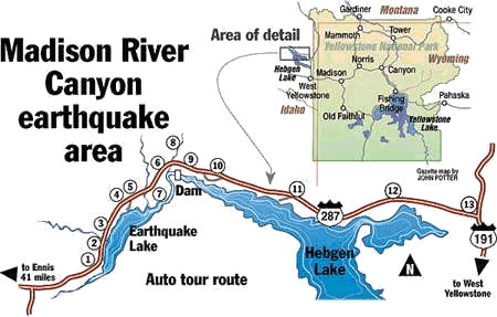
|
The 1959 earthquake in Yellowstone National Park has left behind
reminders visible today. Here are some spots to view, based on
Forest Service information:
Spillway. The
U.S. Army Corps of Engineers cut a spillway across the slide. On
Sept. 10, 1959, water passed through the 250-foot-wide,
14-foot-deep channel. It was deepened to 54 feet on Oct. 17, 1959.
Visitor center and slide. Tourists can view the slide
from the observation room of the visitor center. Listen to an
interpreter's story or walk the trail to Memorial Boulder and an
overlook.
Rock Creek Turnout.
A Forest Service campground lies under 100 feet of water just off
this point. Rising waters killed some campers, while others
escaped.
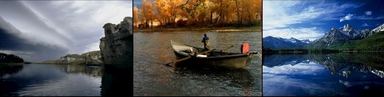
Earthquake Lake.
The slide dammed the Madison River to form Earthquake Lake, which
filled in three weeks and formed a new body of water 190 feet deep
and 6 miles long.
Boat Launch. The
public is still served by this portion of the old highway,
although much of the old roadway lies beneath Earthquake Lake.
Refuge Point.
The ridge provided protection during the night of Aug. 17, 1959,
for many quake survivors. The next morning, FS smokejumpers
parachuted to the point to set up rescue operations. Later that
days, survivors were evacuated by helicopter.
Ghost Village.
Deserted cabins were displaced here from the waters of Earthquake
Lake.
Cabin Creek Scarp.A
21-foot fault severed the old campground at this site.
Hebgen Dam. Though
damaged by tremors and earthquake-caused waves, the earthfill dam
held.
Building
destruction. Take a short walk through this area, and you can
see the old resort cabins submerged in Hebgen Lake.
Road destruction. This
is one of three places where the road collapsed into Hebgen Lake.
Along the old roadbed, you can see where land shifted during the
1959 quake.
Red Canyon. View
the fault scarp that extends 14 miles in this area. A fault scarp
is a cliff created by movement along a fault.
Duck Creek Y. The
epicenter of the quake occurred here.
|