|
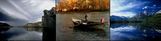
The Blackfoot River, one of twelve
renowned Blue Ribbon rivers in Montana and a major
tributary of the Clark Fork of the Columbia River, begins
at the junction of Beartrap and Anaconda creeks near the
Continental Divide.
The river flows west 132 miles to its
mouth at Bonner, Montana. From its headwaters to Mineral
Hill near the junction of MT 200 and MT 141, the Blackfoot
drops through
 glaciated high-alpine meadows and runs
between steep, forested slopes. Above Lincoln, Montana,
the river almost annually goes underground. Below Lincoln
it reappears and meanders through conifer forests and
wetlands to Nevada Creek. About 4 miles downstream the
river falls sharply toward the North Fork of the
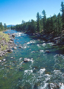
Blackfoot, and cover becomes in-stream rocks and boulders,
bank grasses and brush. For its remaining 52 miles, the
Blackfoot levels out, and moves through open ranch and
timbered areas. It steepens again from the Roundup Fishing
Access Site to Johnsrud Park, 13 miles from the mouth,
passing mostly through a timbered and somewhat narrow
canyon with high walls. From the North Fork downstream,
the Blackfoot lends itself gradually to floating,
swimming, and wading. A free flowing river, the Blackfoot
is affected by Milltown Dam, which has blocked fish
passage on the Clark Fork River since 1907. glaciated high-alpine meadows and runs
between steep, forested slopes. Above Lincoln, Montana,
the river almost annually goes underground. Below Lincoln
it reappears and meanders through conifer forests and
wetlands to Nevada Creek. About 4 miles downstream the
river falls sharply toward the North Fork of the
Blackfoot, and cover becomes in-stream rocks and boulders,
bank grasses and brush. For its remaining 52 miles, the
Blackfoot levels out, and moves through open ranch and
timbered areas. It steepens again from the Roundup Fishing
Access Site to Johnsrud Park, 13 miles from the mouth,
passing mostly through a timbered and somewhat narrow
canyon with high walls. From the North Fork downstream,
the Blackfoot lends itself gradually to floating,
swimming, and wading. A free flowing river, the Blackfoot
is affected by Milltown Dam, which has blocked fish
passage on the Clark Fork River since 1907.
The Blackfoot
River Trout Restoration Initiative focuses on the recovery
of native fish species, and depends on cooperating
agencies, watershed groups, and landowners to protect the
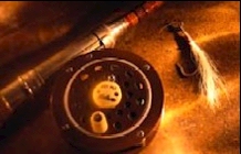
river's many resources and uses.Fishing the Blackfoot:
The Blackfoot is an excellent fishery for rainbow, cutbows, browns and mountain
whitefish throughout its length. Good fishing on the
Blackfoot fishing starts around the River Junction Campground, at
its confluence with the North Fork, just south of Ovando.
The Blackfoot hatches consist of Skwala Stoneflies,
Salmonflies, Golden Stones, Baetis, March Browns, Caddis,
Green Drakes, Midges, Pale Morning Duns and Hoppers.
Total Length: 132 miles
|
Fishing Access Sites
- Aunt
Molly River Mile:
70
- Directions: East of Ovando to Hwy
141, turn south for 1 3/4 miles, then east for 3
miles to bridge.
- Other Info: Carry in launch.
Open all season. 1184 acre(s).
- Cedar
Meadow River Mile:
64
- Directions: From Helmville take
SR 272 northwest for 4 miles.
- Other Info: Canoes/rafts can be
hand launched from site. Non-motorized watercraft
only for Blackfoot R and its tribs. Open all
season. 3 acre(s).
- River
Junction River
Mile: 53
- Directions: 39 miles east of
Bonner on Hwy 200 to Milepost 39, then 9 miles
southeast on Co. Road.
Stay limit is 7 days. Fee required. Contact the
regional office for fee info.
- Other Info: 6 campsites available
at this site. Canoes/rafts can be hand launched from
site. Road to site is very rough. Non-motorized
watercraft only for Blackfoot R and tribs Open all
season. 179 acre(s).
-
Russell Gates Memorial
River Mile: 40
- Directions: 35 miles east of
Bonner on Hwy 200 to Milepost 35.
Stay limit is 7 days. Fee required. Contact the
regional office for fee info.
- Other Info: Canoes/rafts can be
hand launched from site 12 campsites. Non-motorized
watercraft only for Blackfoot R and tribs Open all
season. 41 acre(s).
-
Sunset Hill River
Mile: 31
- Directions: Opposite the
Clearwater crossing FAS take Sunset Hill Road south.
- Other Info: 2 sites - one is at
junction of Clearwater/Blackfoot Rivers, 21/2 miles
south of Hwy 200. The other one is 41/2 miles south
of Hwy 200. Both provide walk-in access only. Open
all season.
-
Roundup River Mile:
29
- Directions: 26 miles east of
Bonner on Hwy 200 to milepost 26, then west on
Ninemile Prairie Road.
- Other Info: "Raft slide" launch
structure. Non-motorized watercraft only for
Blackfoot R and tribs Open all season.
-
Ninemile Prairie
River Mile: 25
- Directions: 26 miles east of
Bonner on Hwy 200 to Milepost 26, then 4 miles west.
Stay limit is 7 days. Fee required. Contact the
regional office for fee info.
- Other Info: Launching boats at
this site is not advised. Only 2 developed campsites
at this location. Non-motorized watercraft only for
Blackfoot R and its tribs Open all season. 14
acre(s).
-
Corrick's Riverbend
River Mile: 23
- Directions: 26 miles east of
Bonner an Hwy 200 to mile post 26, then 71/2 miles
west on Ninemile Prairie Road.
Stay limit is 7 days. Fee required. Contact the
regional office for fee info.
- Other Info: Non-motorized
watercraft only for the Blackfoot River. Open all
season. 32 acre(s).
-
Belmont Creek River
Mile: 21
- Directions: Located 10 miles east
of Johnsrud FAS and 9 miles west of Roundup FAS on
Ninemile Prairie Road.
- Other Info: Walk-in access only
(approx. 500 yds) boat launching is not advised.
Non-motorized watercraft only for Blackfoot R and
its tribs. Open all season.
- Red
Rocks River Mile:
20
- Directions: Approx. 71/2 miles
east of the Johnsrud FAS along the Corridor Road.
- Other Info: 1/2 mi walk from
parking area to site Open all season.
-
Whitaker Bridge
River Mile: 19
- Directions: Approx. 7 miles east
of Johnsrud FAS on the Corridon Road.
- Other Info: Hand launching of
boats is best done 300 yds downstream at an unnamed
day use site. Non-motorized watercraft only for
Blackfoot R and its tribs Open all season.
-
Thibodeau River
Mile: 18
- Directions: 6 miles east of
Johnsrud FAS on the Corridor Road.
Stay limit is 7 days. Fee required. Contact the
regional office for fee info.
- Other Info: 6 camping sites. Road
is rocky and rough. Boat launching is not advised.
Non-motorized watercraft only for Blackfoot R and
its tribs Open all season.
- Sheep
Flats River Mile:
17
- Directions: 4 1/2 miles east of
the Johnsrud FAS on the Corridon Road.
- Other Info: Numerous roads skirt
this area, and provide several access points to the
river down a steep bank. Non-motorized watercraft
only for Blackfoot R and its tribs Open all
season.
-
Daigles Eddy River
Mile: 16
- Directions: 3 miles northeast of
the Johnsrud FAS on the Corridor Road.
- Other Info: Open all season.
-
Johnsrud Park River
Mile: 13
- Directions: 11 miles east of
Bonner on Hwy 200, then west on gravel road.
Stay limit is 7 days. Fee required. Contact the
regional office for fee info.
- Other Info: Day use shelter,
horseshoe pits, volleyball court, and baseball
diamond at this site. Non-motorized watercraft only
for Blackfoot Rand its tribs Open all season. 18
acre(s).
- K.
Ross Toole River
Mile: 9
- Directions: Information being
updated
- Other Info: Seasonal. Contact
the regional office for open and closure dates.
- Marco
Flats River Mile: 3
- Directions: 21/2 miles northeast
of Bonner on Hwy 200.
- Other Info: Canoes/rafts can be
hand launched from site. Non-motorized watercraft
only for Blackfoot R and its tribs Open all
season. 2 acre(s).
NOTE:
All river Fishing Access Sites (FAS)
are listed in descending order by river mile from
headwaters to mouth. The mouth of a stream is its
confluence with another body of water and is
considered mile 0.
|