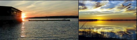
Lake Buchanan is noted
for its excellent striped bass and white bass fishing. It also
contains an under-rated largemouth bass and Guadalupe bass
population. White bass and striped bass runs occur in the spring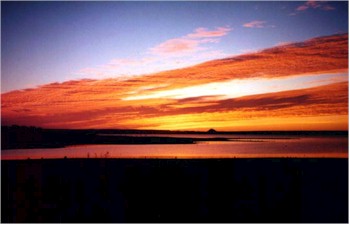 (February-May) with most of the fishing occurring from Beaver Creek
up into the Colorado River. Striped bass do not naturally reproduce
in the reservoir and are stocked by Texas Parks and Wildlife. A low
density white crappie population is present. The upper end of the
reservoir produces many large white crappie each year. Blue,
channel and flathead catfish occur throughout the
reservoir.
(February-May) with most of the fishing occurring from Beaver Creek
up into the Colorado River. Striped bass do not naturally reproduce
in the reservoir and are stocked by Texas Parks and Wildlife. A low
density white crappie population is present. The upper end of the
reservoir produces many large white crappie each year. Blue,
channel and flathead catfish occur throughout the
reservoir.
FISHING COVER/STRUCTURE
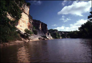
Buchanan offers a variety of cover and structure. The area near the dam
and the east side of the lake up to the Silver Creek area is rocky. This
area has numerous rock piles, ledges, and chunk rock banks. This area is
reminiscent of a highland-type lake. The west side from mid-lake up
looks more like a flatland type reservoir with numerous flat coves that
have a lot of flooded brush to fish when the lake is up. Water color in
the reservoir ranges from clear at the dam and gradually becomes more
turbid as you move up the lake.
ACCESS/CAMPING
There are five good boat ramps, four on the east side and one on the
west side of the lake. The first ramp is
 on the east side of the dam off
Texas Highway 29. Look for the brown sign (HWY 690) that points the way
to the ramp. Burnet County Park, off FM 2341 at mid-lake, has recently
built a new concrete two-lane ramp. This ramp is usually open during
periods of low water. It is susceptible to a northwest wind, so watch
the weather if you launch here. A concrete ramp, well protected from the
wind, is located at Thunderbird Lodge off FM 2341 at (512) 756-4878.
This private facility charges $5.00 to launch. Llano County Park, on the
west side, offers a free ramp off FM 261. This ramp is well protected
from the wind. Unimproved boat ramps are available at Cedar Point
Recreation Area and at Colorado Bend State Park (915) 628-3240.
on the east side of the dam off
Texas Highway 29. Look for the brown sign (HWY 690) that points the way
to the ramp. Burnet County Park, off FM 2341 at mid-lake, has recently
built a new concrete two-lane ramp. This ramp is usually open during
periods of low water. It is susceptible to a northwest wind, so watch
the weather if you launch here. A concrete ramp, well protected from the
wind, is located at Thunderbird Lodge off FM 2341 at (512) 756-4878.
This private facility charges $5.00 to launch. Llano County Park, on the
west side, offers a free ramp off FM 261. This ramp is well protected
from the wind. Unimproved boat ramps are available at Cedar Point
Recreation Area and at Colorado Bend State Park (915) 628-3240.
Location: On the
Colorado River in Burnet County and Llano counties, west of the town of
Burnet
Size: 23,200 acres
Maximum Depth: 132
feet
Date Impounded: 1937
Normal Water Clarity:
Clear to heavily stained
Water Level Fluctuation:
Considerable
Conservation Pool
Elevation: 1020.35 ft. msl
Aquatic Vegetation:
No significant aquatic vegetation present
Facilities & Camping:
The main camping area offers drive-up sites (with picnic tables, fire
rings with cooking grills, a lantern post, potable water in the area);
riverbank tent sites (with picnic tables, fire rings with cooking
grills, a lantern post,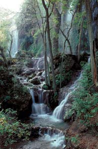 and potable water in the area); chemical toilets, a fish-cleaning table,
and a boat ramp. (It is 9 miles to Lake Buchanan.)
and potable water in the area); chemical toilets, a fish-cleaning table,
and a boat ramp. (It is 9 miles to Lake Buchanan.)
There are also 2 back pack areas where you must carry everything you
need and pack out absolutely everything you don't use. (Bring
containerized fuel to cook; nearest gas station is 35 miles away.) The
River Back Pack Area is about 2 miles from a chemical toilet and water
faucet. The Windmill Back Pack Area is about 6 miles from a chemical
toilet and water faucet. Ground fires are also prohibited everywhere in
the park except in designated fire rings in the main camping area.
There are also two group areas: The developed Live Oak Group Area
where you can drive to the site with picnic tables, a lantern holder, a
large fire ring, water in area, and a chemical toilet in area; the
premium, developed River Group Area where you can drive within 75 yards
of the site with picnic tables, a lantern holder, a large fire ring,
water 1/4 mile, andchemical toilet 1/4 mile. The park has 12.3 miles of
hiking trails and 10.6 miles of mountain bike trails.