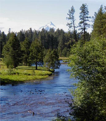
Nestled in a forested valley on the west flanks
of Mt. Jefferson, the Metolius is one of the largest spring-fed rivers in the
United States. The Metolius River originates from springs that rise from the base of Black
Butte, a composite volcano that rises over 3400 feet above the river.
 The river
flows north for 18 miles and then bends east for another 10 miles around the
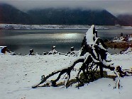
north end of Green Ridge, eventually flowing into the reservoir
Lake Billy
Chinook. Many spring-fed streams are tributary to the Metolius River and
contribute to the high water quality that is characteristic of the watershed.
The river has relatively high velocities and little overhead cover except that
provided by deep water pools.
The river
flows north for 18 miles and then bends east for another 10 miles around the
north end of Green Ridge, eventually flowing into the reservoir
Lake Billy
Chinook. Many spring-fed streams are tributary to the Metolius River and
contribute to the high water quality that is characteristic of the watershed.
The river has relatively high velocities and little overhead cover except that
provided by deep water pools.
The upper Metolius River flows through a basin influenced by glaciation and
volcanism. The tributaries flow east off the slope of the Cascade Mountains and
traverse zones of lava flows, glacial moraines and outwash sand and fine
gravels. The Metolius Basin is a depression identified as a garben, formed by a
central block slipping down between Green Ridge and the Cascades.
The hydrograph of the Metolius River is quite stable due to the spring-fed
nature of many of the tributaries of the upper basin. High precipitation events
occur as rain-on-snow events in late fall or early spring, as well as high
intensity thunderstorms in August. The Cache Creek drainage discharges storm
runoff into Lake Creek, just above its mouth at the Metolius River. Cache, First
and Canyon Creeks have an important influence on the hydrograph of the Metolius
and discharge relatively significant sediment loads compared to other Upper
Metolius Basin tributaries.
The lower river, adjacent to the Warm Springs
Indian Reservation, is managed as a primitive area with no motorized access.
Bull trout, redband trout, kokanee salmon, and
mountain whitefish are native to the Metolius River Basin. Chinook and sockeye
salmon were indigenous to the basin, but are no longer present. Other fish
available for recreational angling include naturalized populations of introduced
brook and brown trout, and hatchery releases of rainbow and cutthroat trout.
|
Fishing Access: |
Wading & bank fishing all along river. There are trails that follow
the east & west banks with some access by road with turn outs. |
|
Physical Characteristics: |
Size: 41.2 miles (which includes about 12 miles of channel flooded
by Lake Billy Chinook). Depth: varies Elevation: 2990'-1940' |
|
|
|
|
Popular Fishing Methods: |
Fly Fishing ONLY above Bridge 99; below Bridge 99 artificial flies &
lures. |
|
Fly Fishing Methods: |
Bank & wading fishing. |