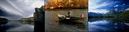
The Boulder
River originates in the rugged, high
elevations of the Beartooth Mountains in the Gallatin National Forest.
It tumbles down 7,300 feet and 60 miles through mixed conifers, deciduous
trees, shrubs, grassland, and agricultural land, to join the Yellowstone
River. Most of its drainage lies within the Absaroka-Beartooth Wilderness.
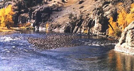
The upper main Boulder cuts through a glacial valley from the headwaters to
Two-Mile Bridge, flowing clear, cold and fast. This 22.5-mile segment combines
rapids, riffles, plunges, long, wide pools, and short stretches of spawning and
rearing habitat in a spectacular sub-alpine setting. As the river runs north
6.5 miles to Natural Bridge and Falls, its gradient lessens, resulting in
clean gravels, riffles, runs, and deep
pools.
Below the Falls, for 4 to 5 miles,
the Boulder meanders through agricultural land to its confluence with the
East Boulder. Its final 28 miles from this point to the mouth are somewhat
steeper and strewn with boulders and cobbles. The main Boulder, East and West
Boulder rivers and their many tributaries provide a wide diversity of
fisheries habitats and recreation opportunities, and sustain an agricultural
economy. The system is part of the habitat required by fish from the
Yellowstone River. It is subject to extreme
runoffs, droughts, wildfire, mass wasting of
soils and rock, and the impacts of agriculture, land development, and channelization. Upper portions of the main
Boulder River are designated Scenic and
have been considered for Wild and Scenic Classification. Exceptions to
Standard Regulations: Entire River And Tributaries
Open entire year.
Combined Trout: 2 daily and in possession, only 1 over 13 inches.
Natural Bridge To Two-Mile Bridge (First Crossing, 5 Road Miles Upstream
From Natural Bridge)
Catch-and-release for rainbow trout, except anglers 14 years of age and
younger may take 1 rainbow trout daily and in possession, any size.
Artificial lures only.
Access: Big Rock Fishing Access Area is located on the
Boulder River at
river mile 5 on the right hand side as you float
down stream. Big Rock is the only access site along the
Boulder River maintained by FWP. The Boulder River is a
tributary of the
Yellowstone River.
Directions
I-90 exit 470 and drive into Big Timber 1.4 miles on Old
Bridger Rd. Turn south and continue 3.5 miles. (Lat
45.793, Lng -109.964) |