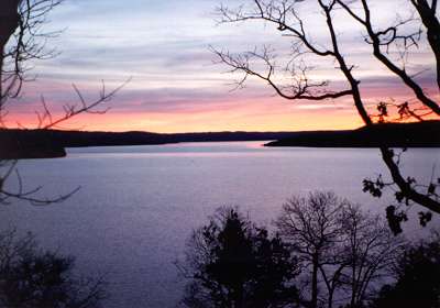
About Beaver Lake
Information complied from various source, photo by Klamath(Gail)
Beaver Lake
is widely recognized as an outstanding fishing resource. The striper
fishery deserves special mention as one of the nation's finest with a
potential to produce record fish in the 50-pound category. Largemouth,
spotted and a new smallmouth fishery add to the reputation of this
Ozarks resource.
Size and Depth
28,220 acres with an average depth
of about 59 feet. Maximum depth of 204 feet occurs near the dam.
Shoreline
The 449 miles of highly irregular
shoreline are composed mostly of broken limestone (chunk rock) and
gravel. Bedrock occurs along cliff areas. Clay and silt are present in
the upper White River and the upper ends of the creeks. Within Clifty
and North Clifty creeks, the bedrock has eroded into scenic and unique
vertical formations, and some waterfalls are present. The entire shore
is publicly owned and managed by the Corps of Engineers. Development is
limited to the recreational areas and a few private docks.
Bottom
About 60 to 70 percent gravel and
cobble-sized rock. Large (house-size) boulders can be found along bluff
areas. Mixtures of sand and silt are present in the backs of coves and
in the upper reaches of the creeks. Mud is present on the flat areas in
coves.Hardwood and cedar trees were left standing in many coves and
along steep areas. They were left along the White River where they are
at least 40 feet deep. Only portions of old roads remain, but many
building foundations can be found. The village of Monte Ne was
inundated, and some of the buildings are visible at and above the
surface.
Water
The lake can be divided into three
major sections. From the dam to about Point 6, the water is moderately
infertile and clear. From Point 6 to the Highway 12 bridge, it is
moderately fertile and clear with a brown to green color. Within the
White River, upstream from the Highway 12 bridge, the water becomes
fertile and brown in color. The three-part separation is due largely to
a lengthy water exchange rate, averaging 11/2 years. A thermocline forms
in late summer that ranges from 20 to 30 feet deep. In the coves,
dissolved oxygen can become depleted below the thermocline. However,
there is sufficient oxygen below the thermocline within the lake to
create a thermal refuge for striped bass. Secchi disk readings, a
measure of transparency, reach maximums of 18 to 20 feet in the lower
lake, 12 to 15 feet in the middle section and 4 to 10 feet above Highway
12 Bridge.
|


